
- 対応
- iOS
どんなアプリ?
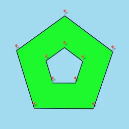
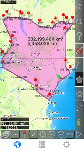
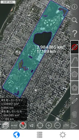
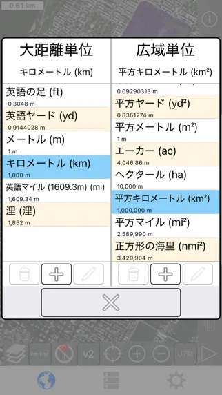
衛星ビューから土地、道路、公園、国、湖などを測定してください。 距離、面積、周囲を計算します。 このアプリケーションが提供する多くの競合他社にはない特徴: - 距離と面積の単位を追加。 - 内部ポリゴンを描画します。 例えば、水域が除去された土地面積などです。 - パスの中央にポイントを追加(ほとんどはパスの終わりにしか追加できません)タップしてパスの終わりに追加します。 長押しすると道の中央に追加します。 - パスまたは多角形の2点を入れ替える。 - GPS受信機から現在の位置情報を追加します。
App Store の説明を全文読む
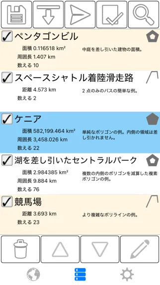
衛星ビューから土地、道路、公園、国、湖などを測定してください。 距離、面積、周囲を計算します。 このアプリケーションが提供する多くの競合他社にはない特徴: - 距離と面積の単位を追加。 - 内部ポリゴンを描画します。 例えば、水域が除去された土地面積などです。 - パスの中央にポイントを追加(ほとんどはパスの終わりにしか追加できません)タップしてパスの終わりに追加します。 長押しすると道の中央に追加します。 - パスまたは多角形の2点を入れ替える。 - GPS受信機から現在の位置情報を追加します。 顔立ち: - 3 マップレイヤーの選択肢 - Dropbox、iCloud、メールなどを通じて.kmlファイルのエクスポートおよびインポート - ピンはドラッグ可能で手動編集可能です - 各パスとポリゴンの名称、注釈、カラーフィールド - メールまたはテキストメッセージの経路およびポリゴンデータ - 4つの冗長モード。 見たい情報だけを見る - 郵便番号、市町村、住所などで検索 - 地図上の地点付近の住所を取得する 4つの描画モード: - パス - 多角形 - 内部に空洞のある多角形 - 編集モードなし(誤編集防止) パスの表示値: - 総距離 - 各ウェイポイントに対する増分距離 ポリゴンの表示値: - 面積 - 周囲長 - 各側の距離 パスやポリゴンに点を追加する方法は4通りのうちの1通りです: - 地図をタップする - 現在の場所を利用する - 座標を手動で入力する - .kmlファイルをインポートする デフォルトの距離単位は以下の通りです: - メーター - 足 - ヤード - キロメートル - マイル - 浬 デフォルトのエリア単位には以下が含まれます: - 平方メートル - 平方フィート - 平方ヤード - 平方キロメートル - 平方マイル - 平方海里 - 平方エーカー - 平方ヘクタール 座標フォーマット: - 度 - 度、分 - 度、分、秒 - UTM / UPS(ユニバーサル横マーカトル)/(ユニバーサル・ポーラーステレオグラフィー) - MGRS(ミリタリーグリッド参照システム) English: Measure land, roads, parks, countries, lakes, etc from a satellite view. Calculates distances, areas, and perimeters. Features that this application offers that most competitors do not: - Add custom distance and area units. - Draw interior polygons. For example, land area with bodies of water removed. - Add a point to the middle of a path (Most only allow you to add to the end of the path) Tap to add to the end of a path. Long press to add to the middle of a path. - Swap two points in a path or polygon. - Add your current location from GPS receiver. Features: - 3 map layer options - Export and import .kml files via Dropbox, iCloud, email, etc - Pins are draggable and manually editable - Name, notes, and color fields for each path and polygon - Email or text message path and polygon data - 4 verbosity modes. See only the information that you want to see - Search by postal code, city, address, etc - Get addresses near point on map 4 drawing modes: - Path - Polygon - Polygon with hollow spaces inside - No edit mode (to prevent accidental edits) Values displayed for paths: - Total distance - Incremental distance for each waypoint Values displayed for polygons: - Area - Perimeter - Distance for each side Add points to a path or polygon in 1 of 4 ways: - Tap on the map - Use current location - Enter coordinates manually - Import .kml file Default distance units include: - Meter - Foot - Yard - Kilometer - Mile - Nautical mile Default area units include: - Square meter - Square foot - Square yard - Square kilometer - Square mile - Square nautical mile - Square acre - Square hectare Coordinate formats: - Degrees - Degrees, minutes - Degrees, minutes, seconds - UTM / UPS (Universal Transverse Mercator) / (Universal Polar Stereographic) - MGRS (Military Grid Reference System)

編集部 PICK UP
Nib
聞き取れるメモ帳。録音すると AI が議事録・要約・次の一手に整えてくれる。
情報
- バージョン
- 2.8
- 最終更新
- 2026/08/22
- リリース
- 2015/08/04
- サイズ
- 6.5 MB
- 必要環境
- iOS 9.0 以降
- 対応端末
- iPhone、iPad
- 対象年齢
- 4+
- 販売元
- Kevin Willett
- 対応言語
- 日本語、AR、BG、CS ほか33言語
最新バージョンの更新内容
- 複数の言語での翻訳改善。 - 小さなバグ修正やレイアウト変更。 - 新しいデバイスやオペレーティングシステムのサポートが改善されました。 English: - Translation improvements for several languages. - Minor bug fixes and layout changes. - Improved support for newer devices and operating systems.