


komoot - ハイキング、バイク
komoot GmbH
App Store 評価: ★ 4.5 (712件)
- 対応
- iOS

どんなアプリ?
Turn your next ride, hike, or run into an adventure with komoot. Get inspired by tapping into shared community knowledge and recommendations, then bring your adventures to life with the easy route planner.
App Store の説明を全文読む
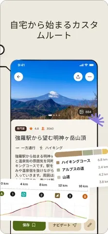
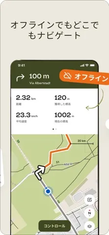
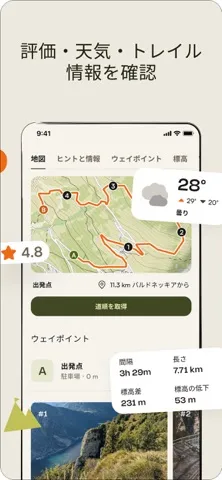
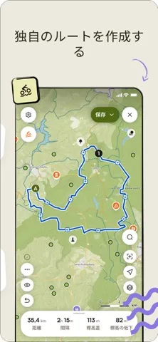
Turn your next ride, hike, or run into an adventure with komoot. Get inspired by tapping into shared community knowledge and recommendations, then bring your adventures to life with the easy route planner. PLAN YOUR PERFECT HIKING, MOUNTAIN BIKING OR ROAD CYCLING ADVENTURE Get the route perfect for your sport—be it smooth asphalt for your road bike, singletracks for your mountain bike, silent cycling paths for touring or natural trails for your hikes. Plan down to the last detail with at-your-fingertips info like surface, difficulty, distance and elevation profile. TURN-BY-TURN VOICE NAVIGATION Never take your eyes off the road with turn-by-turn voice navigation: your precise, down-to-the-inch verbal navigator that doesn’t distract you from your surroundings. Keep your eyes firmly on the adventure in front of you and navigate with ease, even on small trails or in the woods. OFFLINE MAPS FOR OUTDOOR ADVENTURES Download your planned outdoor adventures and save topographic maps with one tap. Navigate the outdoors even when the internet is down or unreliable. Differentiate hiking paths, MTB singletracks or paved roads, terrain and land cover at a glance. BROWSE HIGHLIGHTS: THE KOMOOT COMMUNITY’S FAVOURITE PLACES So you can decide on the destination of your next adventure at a glance, see Highlights on the map. From peaks, parks, and points of interest, to singletracks and sandwich shops, these places or segments, showing up as red dots in the planner, are the spots other users think you should check out. And if you’re in the know, you can recommend your own to the community in turn and inspire others to visit your favourite places, too. TELL YOUR STORY Track your rides and hikes with GPS. Add photos, Highlights and tips and build your own personal adventure log that’ll store your favourite experiences—forever. Save them for private use or share them with the komoot community to receive likes and comments and to inspire fellow outdoor folks. Follow your friends and like-minded explorers to keep up with their outdoor adventures. BE A LOCAL EXPERT. BECOME A PIONEER. Contribute photos, tips and Highlights to the community and show you’re a local Expert. Earn more upvotes than in any else for your sport in your region and become the Pioneer! SEAMLESS SYNC ACROSS EVERY DEVICE Whether you prep like a pro on your desktop or plan a route on the go, komoot automatically syncs your routes, tracked adventures and photos across all devices, including your smartphone, desktop, iPad and Apple Watch. Use a Garmin or a Wahoo? Simply download the komoot for Garmin app in the IQ Store and sync your profiles via Garmin Connect, or connect your komoot and Wahoo accounts to share Tours with the ELEMNT and ELEMNT BOLT. EXPERIENCE KOMOOT FOR FREE When you download komoot, your first region is free—forever. To expand the areas in which komoot has your back, conveniently choose between single regions, region bundles or the World Pack to access offline maps and turn-by-turn voice navigation wherever you go. APPLE WATCH Take a quick glance at your Apple Watch to get directions, distance, and speed in real-time—right on your wrist. APPLE HEALTH You can connect komoot to Health to ensure your data is always up-to-date. Automatically share your time and distance data for komoot hiking, cycling, and running activities with Health. “Komoot does for hiking and biking what Apple does for hardware: makes it easily accessible and fun to use.” — Cult of Mac For support and tips, please visit help.komoot.de MORE INFORMATION Komoot uses background audio service for voice navigation messages. Komoot requires a GPS signal for directions, Tour recording and speed in real-time. Terms of Use: https://www.apple.com/legal/internet-services/itunes/dev/stdeula/

編集部 PICK UP
Nib
聞き取れるメモ帳。録音すると AI が議事録・要約・次の一手に整えてくれる。
人気の推移
App Store(日本)の公式ランキングと評価数を APPBASE が毎日記録しています。
- ヘルスケア/フィットネス・セールス 最高87位 (8/15)
| 日付 | ヘルスケア/フィットネス・セールス |
|---|---|
| 8/22 | 96位 |
| 8/21 | 95位 |
| 8/15 | 87位 |
| 8/7 | 95位 |
App Store のレビュー
App Store に投稿された実際のユーザーレビューです(公式フィードから自動取得・最新順)。
-
★★★★★ iPadOSでの改善希望
iOSでは問題ないのだが、iPadOSでは「タブバー(ナビゲーションバー)」が消えて操作が出来ない。 例えば、「記録」をタップして表示された画面の左上の「×」をタップすると、「タブバー(ナビゲーションバー)」が消失して他のナビゲーション項目を選択できず、アプリを終了させて再度起動して「タブバー(ナビゲーションバー)」を表示させないと操作が出来ない。 早急に改善して欲しい。
ポタリング71 ・ 2026年8月21日 ・ v2026.33.3
-
★★★★★ Ok
Need waaaaaay too much personal info. Works decent but can’t recommend at all
zsmokes ・ 2026年7月14日 ・ v2026.28.7
-
★★★★★ 初めてルートを作ってみました
無料でルート作成ができると言うことでダウンロードしてみました。他のアプリではページを変えることにトライアル期間を進めらられてうんざりしてアプリを削除しましたが、こちらはそんなこともなくスムーズにルート作成ができました。
オカローザ ・ 2026年7月1日 ・ v2026.26.2
-
★★★★★ GPSウォッチ用に
飛騨高山ウルトラのルートをダウンロードしました。 サブスクに強要されるのが残念です。
じゃがりこボルダーさね。 ・ 2026年6月7日 ・ v2026.22.3
-
★★★★★ iPhoneでの文字入力
概ね満足していますが、iPhoneでメッセージ機能に文字入力をすると変換が出来ず、小文字も☻マークになってしまいます。直して欲しいです。
コロ助Z ・ 2025年12月7日 ・ v2025.48.5
-
★★★★★ 使えなくもないが…
サイクリング向けに車体ディスプレイとリンクできるナビとしてダウンロード。 自転車圏内くらいなら無料分で足りるし、ルート保存、帰路の反転、記録しつつ走行や詳細なデータなど色々揃っている。 他の人の走行ルートで走れる機能も面白い。 …が『ルートが最短距離にこだわりすぎて右左折が死ぬほど入る』。 ナビとしては致命的で、何度も指示が細かく出るせいで道をすぐ間違える(サイクリングではよく目を離すのでなおさら)。 何...
フェネック好きのゲーマー ・ 2025年11月2日 ・ v2025.42.5
レビューの続きは App Store で読めます。
情報
- バージョン
- 2026.34.1
- 最終更新
- 2026/08/26
- リリース
- 2011/07/11
- サイズ
- 307.2 MB
- 必要環境
- iOS 17.0 以降
- 対応端末
- iPhone、iPad
- 対象年齢
- 4+
- 対応言語
- 日本語、HR、CS、DA ほか16言語
最新バージョンの更新内容
What's new? - The Offline tab is now available to everyone — your home for offline routes and maps, so you're ready for your next adventure. Bug fixes - Fixed several crashes and route planning issues. - Improved activity and photo uploads. - Fixed issues with custom waypoints and imported routes.