
- 対応
- iOS
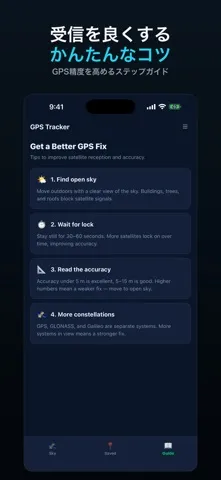
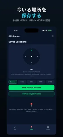
どんなアプリ?
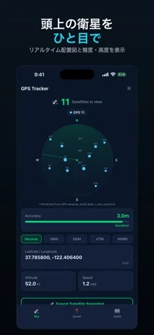
iPhoneのGPS位置データを、見やすい衛星スカイビジュアライゼーションと一緒に確認できます。GPS Satellite Tracker+は実際の位置データを読み取り、アニメーションレーダーチャート上に推定衛星位置と共に表示します。 衛星スカイレーダー アニメーション極座標チャートにGPS、GLONASS、Galileo衛星の推定位置を表示します。衛星位置は軌道データに基づいて計算され、数と信号品質は現在のGPS精度を反映します。 精度ゲージ 現在の測位精度をメートル単位でビジュアルバーに表示し、優秀・良好・普通・不良の明確な品質ラベルを提供します。位置固定の信頼性を一目で確認できます。 座標と位置 iPhoneのGPS受信機から連続的に更新される緯度と経度を十進度形式で確認できます。 高度と速度 海抜高度と地上速度をリアルタイムで監視します。アウトドア活動や移動時に便利です。
App Store の説明を全文読む
See where you are, how good the fix is, and which GPS satellites are overhead — with a sky map computed from real orbit data. SATELLITE SKY MAP A polar chart places the GPS constellation above you, computed from the public GPS almanac (US Coast Guard / CelesTrak) propagated with the standard orbit equations for your position and the current time. It is refreshed weekly and works offline from a bundled copy. These are PREDICTED positions, and the app labels them as such on screen. iOS gives apps no per-satellite data at all — no live signal strengths, no which-satellite-is-in-use, and no GLONASS or Galileo. What you see is where the GPS satellites actually are, not what your receiver is hearing from them. POSITION AND FIX QUALITY • Latitude and longitude, in your choice of format • Accuracy in metres with a plain quality rating • Altitude, ground speed and course • A gauge that tells you at a glance whether the fix is worth trusting WAYPOINTS Save a spot, navigate back to it with distance and bearing, and get an arrival alert. Export the lot as CSV or GPX. LOCK SCREEN CARD While the app is open, a Live Activity shows accuracy, altitude and speed on the Lock Screen and in the Dynamic Island. It cannot keep updating once the phone is locked — this app does not run location in the background — so it marks itself PAUSED rather than leaving a stale reading looking current. WHO USES IT Hikers and paddlers checking fix quality before relying on it · paragliding and drone pilots · surveyors wanting a quick accuracy read · anyone curious what is overhead right now Available in 25 languages.

編集部 PICK UP
Nib
聞き取れるメモ帳。録音すると AI が議事録・要約・次の一手に整えてくれる。
人気の推移
App Store(日本)の公式ランキングと評価数を APPBASE が毎日記録しています。
評価数の推移
現在 4 件 (8/2から +1 件)
数値で見る
| 日付 | 評価数 |
|---|---|
| 2026/8/24 | 4件 |
| 2026/8/2 | 3件 |
情報
- バージョン
- 1.1.22
- 最終更新
- 2026/08/12
- リリース
- 2026/03/10
- サイズ
- 61.7 MB
- 必要環境
- iOS 16.4 以降
- 対応端末
- iPhone
- 対象年齢
- 17+
- 対応言語
- 英語
最新バージョンの更新内容
ロック画面のカードが嘘をつかなくなりました。 このカードはアプリが開いている間しか更新できません。このアプリはバックグラウンドで位置を追跡しないからです。つまり本体をロックした瞬間——カードが実際に見えるようになる瞬間——最後の値で凍りつき、そのまま何時間も現在値のように見えていました。今は**一時停止**と表示され、最後に測位した時刻も添えられます。止まった数値を実時間と取り違えることはありません。アプリを開き直せば再開します。 そのほかの変更: • 測位できた瞬間に出ていた全画面広告を廃止しました。測位はユーザーが求めた操作ではありません。その瞬間の広告は「アプリを開いた代償の広告」に見えます。今は座標をコピーしたとき——実際に欲しかった結果——に出ます。 • 説明から「GLONASS・ガリレオ衛星をリアルタイムで追跡」という記述を削除しました。iPhoneでは不可能です。**iOSはアプリに衛星ごとのデータを一切提供しません。**リアルタイムの信号強度も、どの衛星が測位に使われたかも、GPS以外の測位系も取得できません。スカイマップは公開アルマナックから、現在地と時刻に対するGPS衛星の実際の位置を計算して表示し、予測である旨を明示しています。画面上は元から正直でした。今回ストアの記載がそれに追いつきました。