

CoMaps
Anton Wenemoser
App Store 評価: ★ 4.2 (16件)
- 対応
- iOS

どんなアプリ?
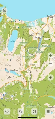
A community-led free & open source maps app based on OpenStreetMap data and reinforced with commitment to transparency, privacy and being not-for-profit.
App Store の説明を全文読む
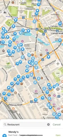
A community-led free & open source maps app based on OpenStreetMap data and reinforced with commitment to transparency, privacy and being not-for-profit. ‣ Simple and Polished: essential easy to use features that just work. ‣ Offline-focused: Plan and navigate your trip abroad without the need for cellular service, search waypoints while on a distant hike, etc. All app functions are designed to work offline. ‣ Respecting Privacy: The app is designed with privacy in mind - does not identify people, does not track, and does not collect personal information. Ads-free. ‣ Saves Your Battery and Space: Doesn’t drain your battery like other navigation apps. Compact maps save precious space on your phone. ‣ Free and Built by the Community: People like you helped build the app by adding places to OpenStreetMap, testing and giving feedback on features and contributing their development skills and money. ‣ Open and Transparent Decision-making and Financials, Not-for-profit and Fully Open Source. Main Features: • Downloadable detailed maps with places which are not available in many commercial maps • Outdoor mode with highlighted hiking trails, campsites, water sources, peaks, contour lines, etc • Walking paths and cycleways • Points of interest like restaurants, gas stations, hotels, shops, sightseeings and many more • Search by name or an address or by point of interest category • Navigation with voice announcements for walking, cycling, or driving • Bookmark your favorite places with a single tap • iCloud sync for your bookmarks and tracks • Offline Wikipedia articles • Subway transit layer and directions • Track recording • Export and import bookmarks and tracks in KML, KMZ, GPX formats • A dark mode to use during the night • Improve map data for everyone using a basic built-in editor • CarPlay support Freedom Is Here Discover your journey, navigate the world with privacy and community at the forefront!

編集部 PICK UP
Nib
聞き取れるメモ帳。録音すると AI が議事録・要約・次の一手に整えてくれる。
人気の推移
App Store(日本)の公式ランキングと評価数を APPBASE が毎日記録しています。
評価数の推移
現在 16 件 (8/2から +1 件)
数値で見る
| 日付 | 評価数 |
|---|---|
| 2026/9/6 | 16件 |
| 2026/8/2 | 15件 |
情報
- バージョン
- 2026.08.31
- 最終更新
- 2026/09/01
- リリース
- 2025/06/28
- サイズ
- 147.6 MB
- 必要環境
- iOS 15.6 以降
- 対応端末
- iPhone、iPad
- 対象年齢
- 4+
- 対応言語
- 日本語、AF、AR、AZ ほか40言語
最新バージョンの更新内容
• Modes UI and transport-specific map styles • Display favorite names on the map (opt out in settings) • Custom map font size setting • Support roadshields in Kyrgyzstan, Uzbekistan, Tajikistan, Kazakhstan and Georgia • Supply dark and light turn image variants for CarPlay • OSM editor: added more categories (prison, dojo, bowling_alley, lounger, shop=craft, golf_course, miniature_golf and attraction rides (roller_coaster, carousel...) and assembly points) • Fixed ability to search in any user-set map language (not just EN and local language) • Use unrestricted lanes for lane guidance in Go Straight instructions • Don't interpret fee=donation as paid • Enabled Macedonian language voice instructions • Fixed asking for location before protected data is available • Fixed route preview button disappearing • OpenStreetMap data as of August 30 and further weekly updates